Mission
CFOSAT Mission requirements
CFOSAT is a pre-operational mission of joint measurements of winds and waves which aims is to supply wind/wave observations in near-real time to the meteorological agencies to improve their forecast and sea state models. These measurements will also be supplied to the scientific community for the oceanographic and climate research to improve sea models as well as our understanding of the influence of the sea state on surface fluxes.
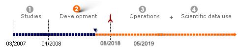
- Mission duration: 3 years at least,
- Data availability: Near-real time (less than three hours after acquisition) for the meteorological agencies,
- Data distribution:
- on request through a server and an authentication for the scientists,
- systematically through meteorological servers for the meteorological agencies.
- Coverage: global at a 13-day scale for SWIM and at a 3-day scale for SCAT,
- Altitude: 520 km

Main Objectives regarding the ocean surface
CFOSAT is designed to provide, at a global scale, observations of the ocean surface wind and the spectral properties of surface ocean waves. The objective is multifold. It will serve both operational needs for the surface wind and wave forecast (marine meteorology and climatology), and research needs by improving our knowledge on the wave hydrodynamics, of the interactions between waves and the atmospheric or oceanic layers close to the surface, and of the interactions between electromagnetic signals and the ocean surface.
These main objectives can be detailed as follows:
- Modelling and prediction of ocean surface wind and waves
- Physical processes of wind and waves
- Interactions between surface waves, atmosphere and ocean
- Interactions between electromagnetic signals and the ocean surface
- Wave evolution in coastal regions
Opportunity studies of polar ice sheet and land surface processes
The objectives listed below are secondary objectives to the CFOSAT mission, and specifications related to these goals are to be met on a best effort basis.
Scientific requirements to fulfil the objectives of CFOSat
The payload is composed of two instruments: a wind-scatterometer (SCAT) and a wave-scatterometer spectrometer (SWIM: Surface Waves Investigation and Monitoring instrument). The requirements are:
- to estimate directional spectra of ocean waves along the satellite track at scales ranging from 50 x 50 km² to 70 x 70 km²
- to transmit data in near real-time within 3 hours after acquisition
- to estimate wind speed and significant wave height from nadir-looking beam, in a way similar to altimeter missions
- to estimate the wind vector over a swath of about 900 km with a nominal resolution of 50 x 50 km² (goal 25 x 25 km²)
- to sample spectral wave properties with a global coverage at a temporal scale of 10 to 15 days
- to sample wind with a global coverage at a temporal scale of 1 to 2 days
- accuracy for wave estimates: minimum detectable wavelength of about 70 m, maximum detectable wavelength about 500 m, accuracy in wave propagation direction of about 15°, accuracy in wavelength of 10 to 20%, accuracy in significant wave height of 10% or better than 40-50 cm (TBC)
- accuracy on wind speed estimates of ±2 m/s or 10% (whichever is larger) and on wind direction of ±20° in the range 4-24 m/s
- to estimate the radar cross-section dependence with incidence (from 0 to 10° and from 18 to 50° for SWIM and SCAT, respectively) and azimuth, in order to derive from these profiles:
- properties on the statistics of the sea surface slope (mean square slope, shape of the slope probability density function)
- estimate of wind direction and wind speed
- in the polar ice sheet, the contribution of volume scattering with respect to surface scattering, and ice surface and snow pack characteristics
- humidity and roughness of bare soils over land surface.